The much-awaited pattern change is upon us. It should herald the arrival of more seasonable air in Eastern – and perhaps Central – North America as we move through the next week and half.
The impetus behind the shift is a vigorous storm system moving through the Midwest early this week. It’s not necessarily defining the change as much as it’s signaling it. In other words, it alone won’t rearrange the atmosphere, but it will be followed by other weather systems that will.
Here’s what it will look like in 10 days.
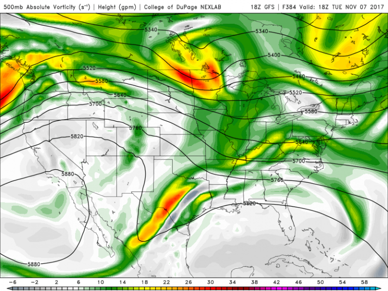
While the circle of high pressure remains in the West, the East has been transformed – and is much more active (note all the lines and green and yellow blobs…lots of activity in the jet stream).
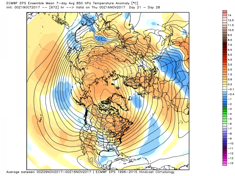
Our main interest is in the 15-20+ day period, but it’s essential to get the shorter range forecast down to understand how it will evolve in the subseasonal range. This shift toward a more active jet stream foretells the end of the 10-15 day stretches of stagnant weather across North America as we transition towards winter in the coming weeks. How do we know this? Well, heat loss at the North Pole is accelerating in turn tipping the heat budget in the Northern Hemisphere. As this continues through January, temperature contrasts drive the jet stream, which in turn drives the weekly weather trends.
This is where the forecasts get very tricky, and this coming setup is no different.
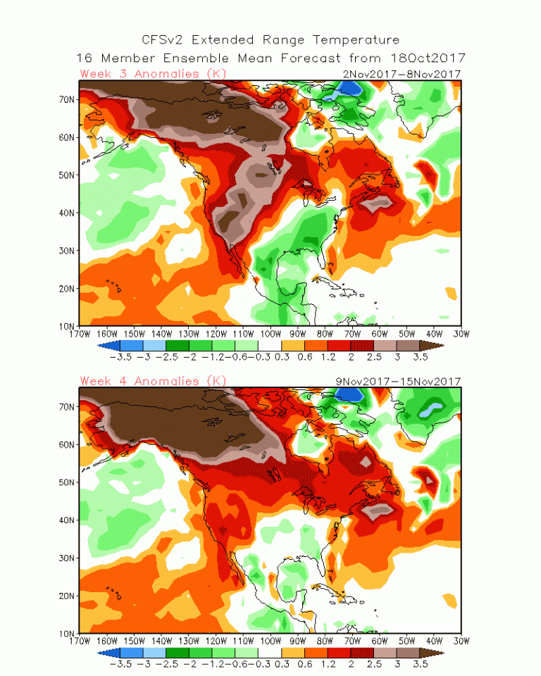
Take for instance the forecast from the CFSv2 in for early November.
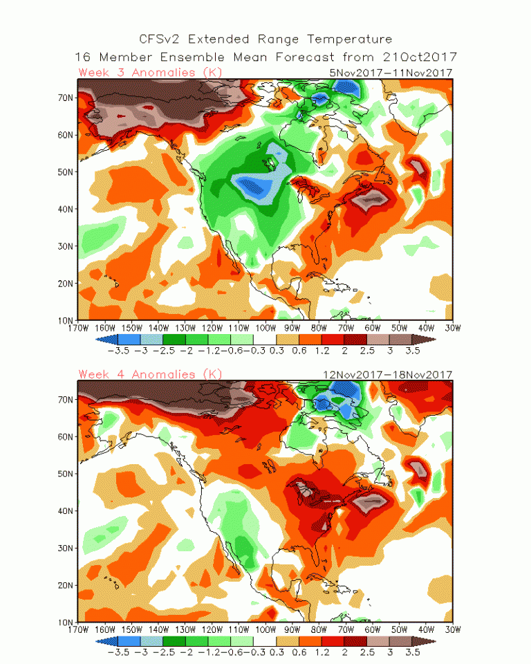
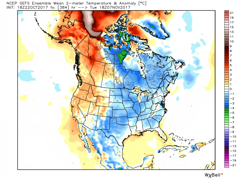
The most recent forecast for surface temperatures is above. Note the cold in the Plains into early November. Not but three days ago, that was trending towards the Southeast US.
There are some strong points to this forecast. Warmth is dominating in all time periods – and in all forecasts – across the Yukon and Western Nunavut, and across Maritime Canada. Safe havens? Perhaps, but we need to keep investigating.
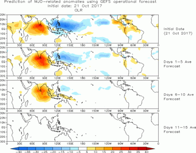
The MJO has been off the charts (relatively speaking) recently. That seems to be fizzling in the coming weeks as it marches out of the Western Pacific (note the blue).
With the signal waning, we’re looking for other controls in the subseasonal time frame. Our go-to is the standing signal from La Nina. While not a blockbuster event, it’s subtle enough to have a hand in driving the pattern.
While that would favor cool weather in the West and warm weather in the East, it doesn’t seem that is in the cards for early November.
But slowly it may take that turn once the cold is expended in the 15-20 day period.
This is key to the forecast: early season cold is simply unsustainable when not coupled with an advancing snow pack.
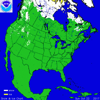
The snow extending from Slave Lake to Hudson Bay may be doomed as the warm air floods the region before Halloween. This will take the sting out of any cold that surges into the Lower 48 in the coming weeks. However, if sustained into late November, and coupled with more blocking in the high latitudes, it could be something to watch.
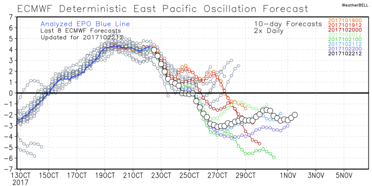
Tall order this early in the season, but if the Eastern Pacific Oscillation (EPO) is correct, this may be sustainable into at least the early part of November. ![]() The latest projections show a huge dive in the EPO into early November.
The latest projections show a huge dive in the EPO into early November.
What could this mean for the upcoming month? Correlations for a negatively phased EPO are as follows.
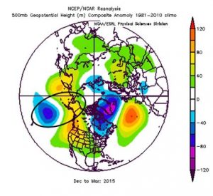
Note that a sustained negative phase of the EPO would produce the couplet (in the oval) over the North Pacific that could maintain a cold pattern for Eastern North America – as it did in the above image for much of the winter of 2015.
Time will tell if this feature has staying power.