There’s been plenty of chatter in the last week about the huge stratospheric warming event that took place.
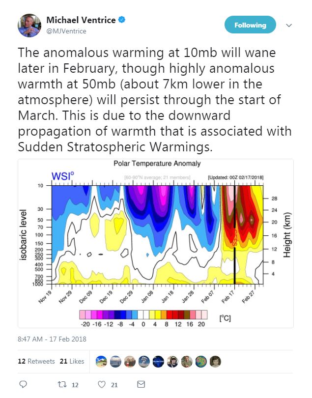
We are seeing the results of that now with a disruption of the Polar Vortex and a warming of the Arctic.
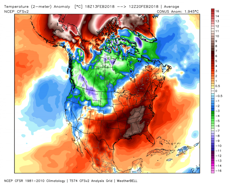
Cold has nestled into the West while record warmth has surged along the Eastern Seaboard.
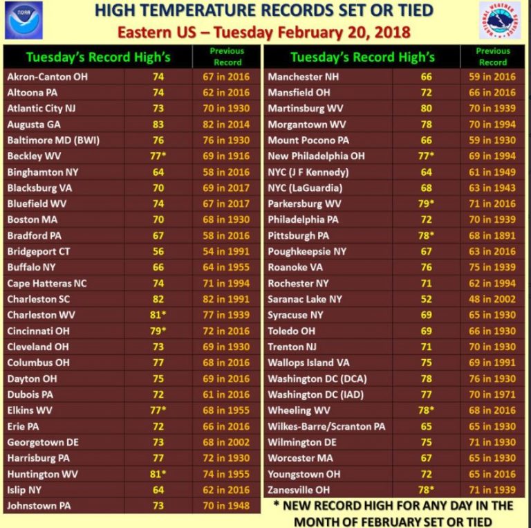
More records will fall in the days ahead before an atmospheric block – a direct result of the aforementioned stratospheric warming event – sets up across the high latitudes. This block will secure the cold in the West and push the East Coast warmth into Eastern Canada through early March.
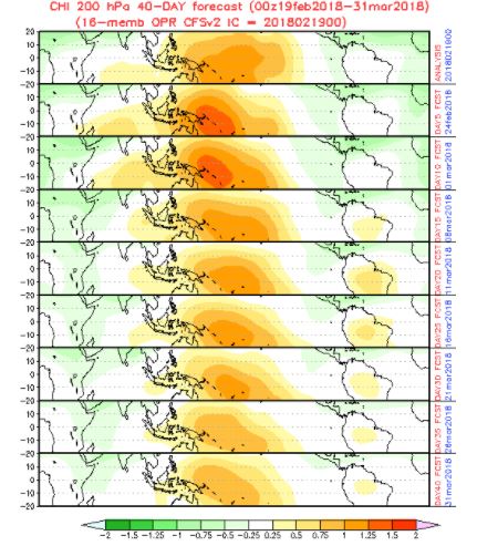
Meantime, the tropics are entering the transitional phase of spring. The main driving component of winter, the Madden Julien Oscillation (MJO), seems to be flippant about continuing in this role as it stalls out over the Central Pacific in the coming weeks.
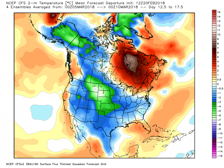
This leads me to believe that we’re basing our projections in the 20+ day period with what’s left of the stratospheric warming event. This is actually good news if history is any indication. Following these events, the pattern is relatively stable and predictable – both warm and cold regions are likely to stay that way in the 3 week period. Indeed, that seems to be the case out to what would be almost mid-March.
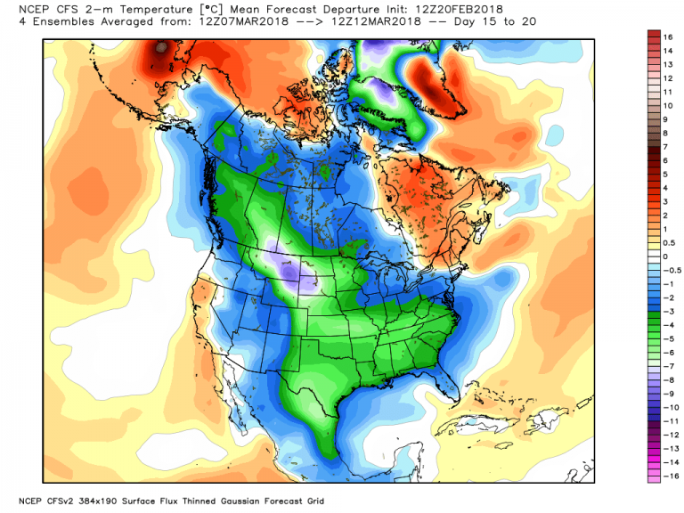
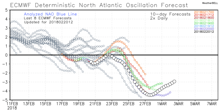
If you scroll up a little to the previous week, you can see there’s very little difference. While most of the Lower 48 appears cold, I would hedge my bets that much of it will be bottled up in the Southeast as the North American Oscillation (NAO) steers the pattern and funnels “normal” winter cold in the Upper Plains well into the Deep South. Closer to home, this same setup may in turn jeopardize the citrus and strawberry crops in Florida as freezes could possibly descend deep into the central and southern parts of the state. Indeed the NAO is projected to be near record territory at over 4 sigma below normal!
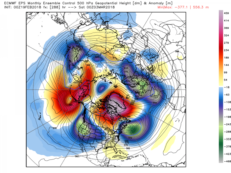
Not only is this driving the pattern across North America, but it is also controlling the balance of warm and cold across the European Continent – the huge high over Greenland ensures the cold will dive deep into most of Europe.
All in all, this is a very confident forecast in the 2-3 week period. Stability is the key to the confidence, and with the stratospheric warming and the NAO in the driver’s seat, the atmosphere is locked.