After a bitter start to the new year for Eastern North America, the pattern seems to have “straightened out” and allowed for occasional bursts of mild air to squeak through the Lower 48.
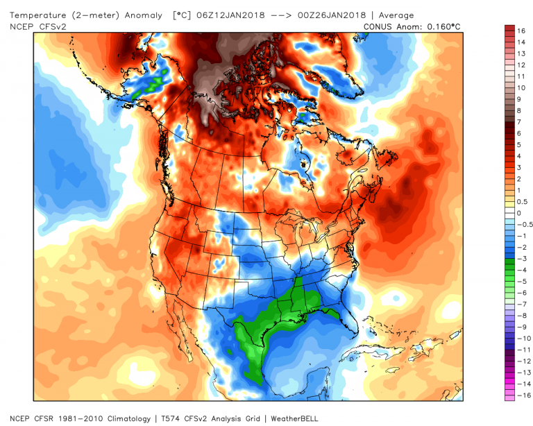
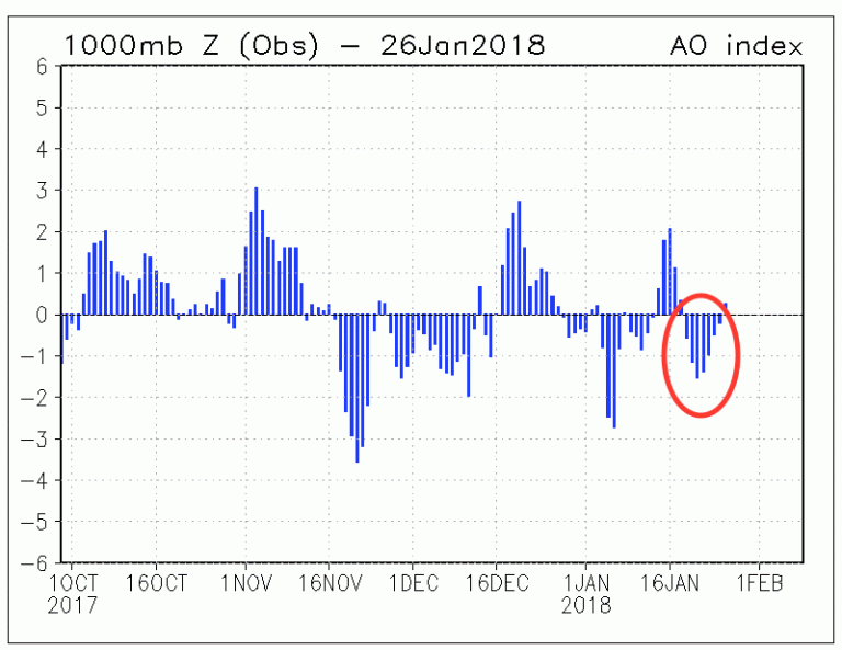
There’s obviously one glaring exception: the Southeast US, where cold air has pooled throughout the Gulf coast on a few occasions over the last two weeks. It’s no wonder, however, that a good part of North America saw above normal temperatures. The Arctic Oscillation (AO) flipped after the 1st of the month, resulting in a retreat of the cold (somewhat) back to the Arctic Circle.
Meantime, in the background, La Nina continues its death grip in the Eastern Equatorial Pacific.
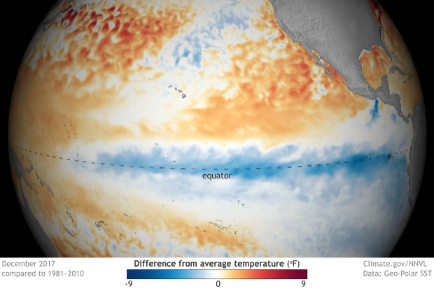
Some signs are pointing to a weakening of La Nina in the coming months, something everyone will be keeping a sharp eye on for implications into the summer and fall. Meantime, the next pattern change is unfolding across the North Pacific and subsequently, North America.
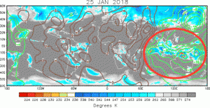
Recently, the Madden Julien Oscillation (MJO) kicked into high gear across the Indian Ocean. With its flaring convection and movement in the Maritime Continent this week
the stage is set for a big shift in the cold in the coming week. At first glance, this blast across Southern Canada and the eastern 2/3 of North America appears to be reminiscent of the bitter air that invaded at the end of December.
Or is it?
While the signs all point to cold, the models have been a little less enthusiastic about its strength and longevity. Last night’s run of the ECMWF Weekly was half-hearted about the prospects of well below normal temps – except across Ontario and Quebec.
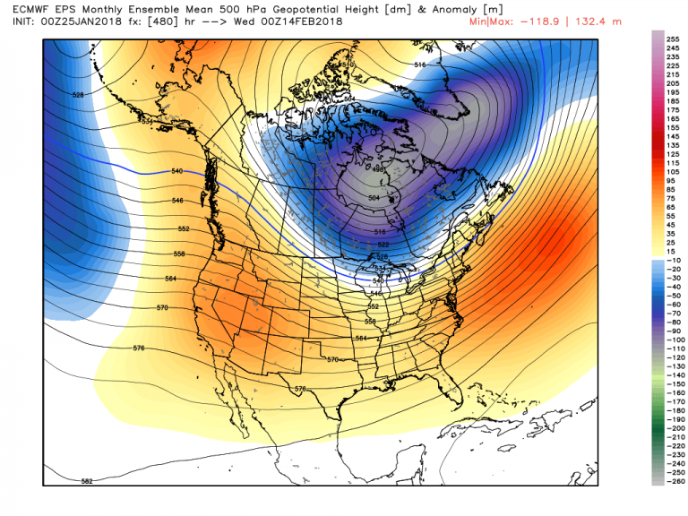
The Lower 48 seemed to be spared the intense, prolonged cold. In essence, this may be a signal that the blast WON’T be as cold as December. In this case, the signal for cold may be strongly positive, but the intensity may be marginal. That’s an important distinction between the two.
What’s may be lost in the cold hype is the overpowering strength of the warmth in the West instead.
Note that the building high pressure system over the Intermountain West is nothing short of remarkable. Highs will soar 10-20 degrees above normal as this area undergoes a major spring thaw (unfortunately, there’s not much to thaw with the paltry snowfall so far this winter).
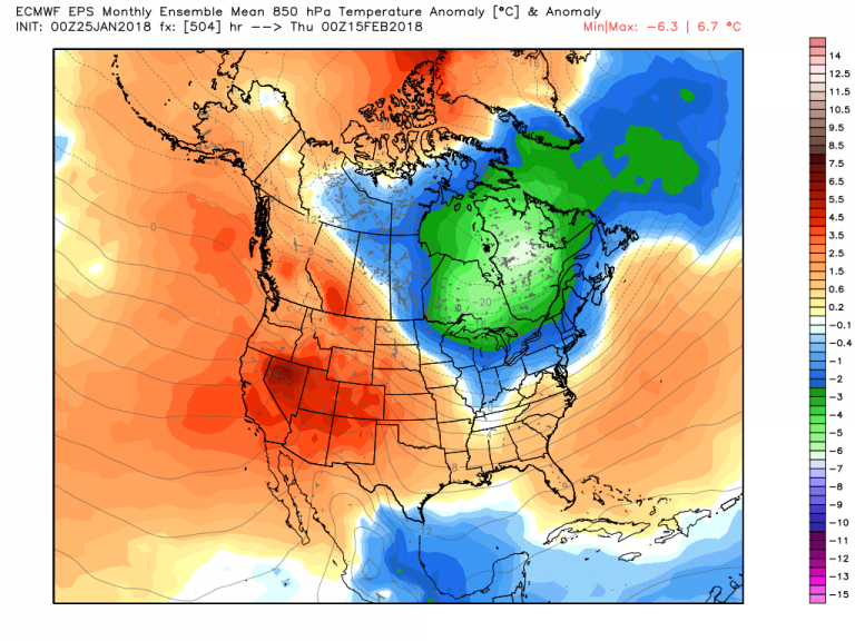
Same goes for Alaska, where the winter has been far from cold and the sea surface temps remain well above normal in the Bering Sea.
This warm West/Cold East pattern seems to be locking through at least mid-February, before the cold relents and more maritime air floods the Lower 48. And I honestly feel this may be the sequence of events that will carry us through to the end of meteorological winter. We have fallen into a cadence with the pattern. Much of this winter has been highly predictable thanks to the strong signals across the Pacific.