With the start of the solar winter – November 1st – the cold season is officially upon us. Midwinter cold is certainly established across north central Canada. Temperatures there have averaged several degrees below normal for the last week.
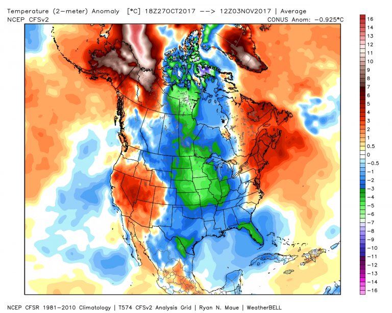
You may be keying in on the cold across the Northern Plains of the US too. While that may be significant, it’s also temporary. The southern end of that blob will modify (or warm) in the coming days.
What’s this mean for the long term? Well, the cold will compartmentalize as a big Greenland Block steals the show.
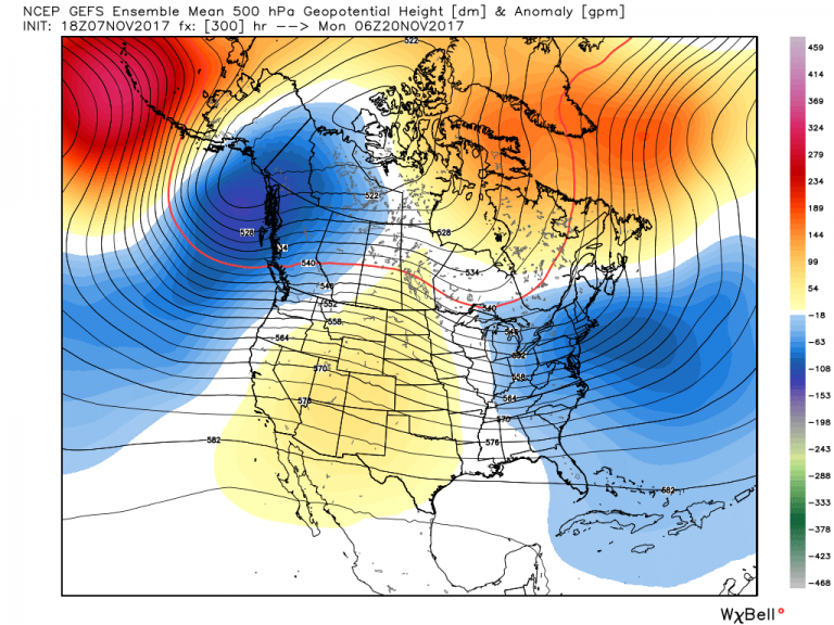
Note the dark oranges and reds. Those correspond to areas of higher than normal pressure in the upper atmosphere. And they translate to warming at the surface. Yes, Greenland is warming up – partly due to open sea water resulting from global warming, but that’s the topic for another day – and the Kamchatka Peninsula is warming as well. This pinches the cold into two spots: Alaska and the Eastern United States. The implications are huge on temperature, and the forecast confidence is riding high.
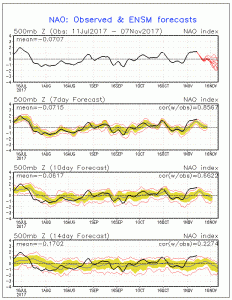
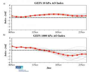
In essence, what we’re seeing evolve is a the negative phase of the North American Oscillation (-NAO). See the red lines in the first graph? They’re all moving in the negative direction.
For the next two weeks, the -NAO will drive the pattern. But what happens after that?
Lest we forget, La Nina is still a force to be reckoned with. Blue shading shows that sea surface temperatures are below normal.
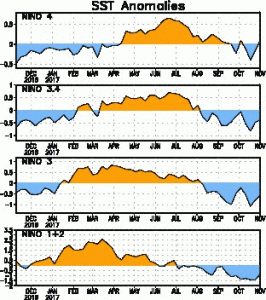
The forcing from the Tropical Pacific is significant year around. With the -NAO relaxing in the long range (3+ weeks) it seems that it may be time for a La Nina pattern to flex.
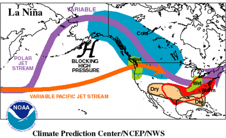
Notice the similarities? It’s essentially the -NAO with a twist. Instead of seeing the cold pool over Alaska, it shifts east and surges into the Northern Rockies and High Plains. It’s certainly not a lock for the 3+ week period, but it could easily morph into this state as the -NAO dissolves. In fact, as the snow pack continues to become established in Western and Central Canada as well as the Northern US, it adds credence to the idea of cold into early December.
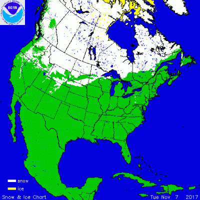
More pointedly, cold often follows the snow pack…especially as we slip into winter. Admittedly, the winter pattern is a fickle one, and it wouldn’t take much to buck the trend and spoil the stew. With the Arctic Ocean still slowly freezing over, open waters wreak havoc with the pattern by feeding warmer air to the atmosphere. This in turn will disturb the Arctic Oscillation. Along with the monitoring the stratosphere for sudden warming, that is the biggest issue going into the month of December. So far the Arctic Oscillation is trending negative, leading to the blocking that we will see in the coming weeks.
Now with a sudden warming of the stratosphere, the roulette wheel starts spinning. Blocking in the high latitudes could show up in many different places, and upend the stability we will see going into Thanksgiving week.
Lots of drama ahead as winter takes center stage.