Over the past month, the weather pattern across the Northern Hemisphere has been dominated by the North Atlantic Oscillation, or NAO.
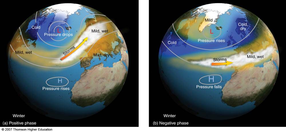
For those new to the term, the NAO references the upper atmospheric pressure in and about Greenland. When the pressure over Greater Greenland is above normal the NAO is said to be in a positive phase, when the pressure is below normal, the NAO is in a negative phase.
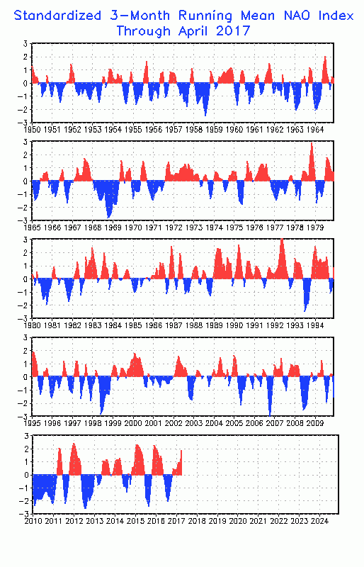
What’s most intriguing about the NAO is that it’s been a minor player since late 2016, when it was also strongly negative by about 2 sigmas.
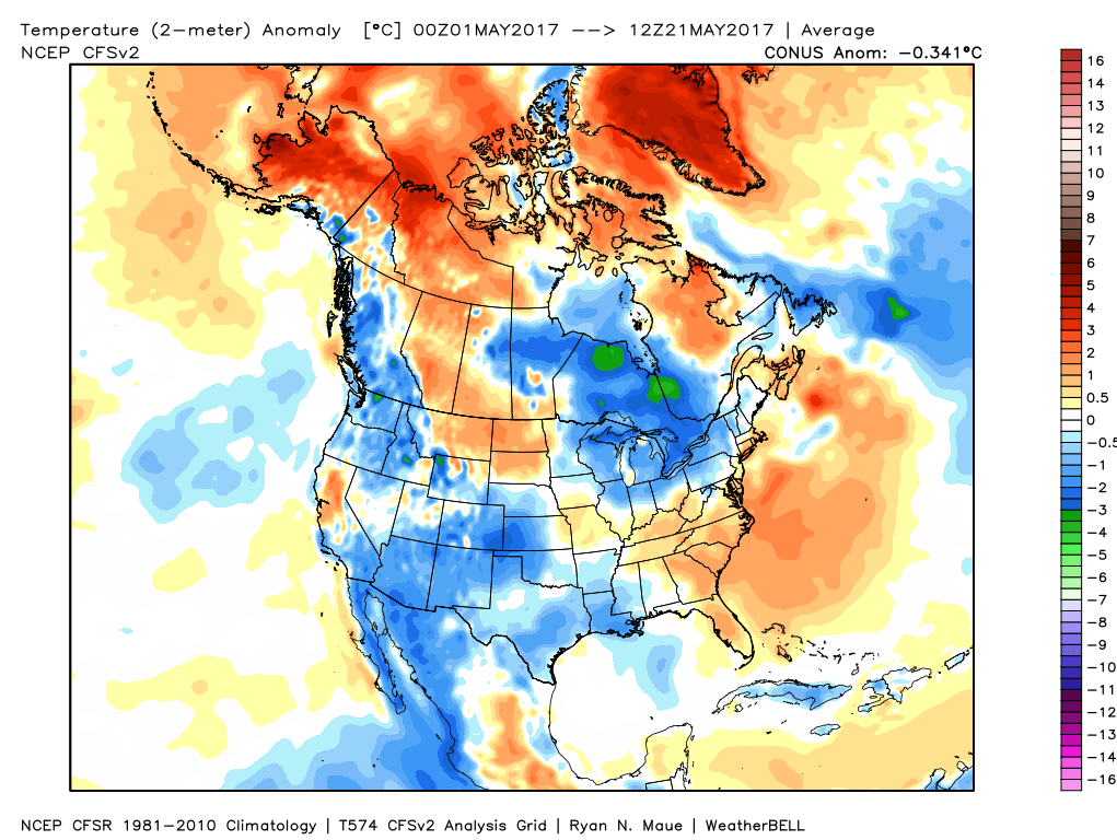
With ENSO forcing still in the never-never land, and moderate phases of the Madden Julian Oscillation only occasionally influencing the pattern, all signs point to the NAO as being the driving force behind the early summer weather pattern – provided it can keep the strong momentum we have seen in the past 3-4 weeks. Speaking of, the almost clock-like shift from warm to cool (and vice versa) over the Lower 48 has been impressive, and almost in a 1-2 week interval since the end of meteorological winter (and some would argue mid-winter). After a record warm week in the East – which saw Boston’s first May heatwave in 16 years – it appears that the East is primed for another cooldown into Memorial Day Weekend.
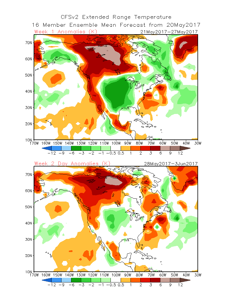
The bigger question, however, is whether or not this pattern has staying power into early and mid-June. With the stellar predictability of the NAO, one would have you believe that another warm-up is likely into the first week of June. Indeed that may be the case as the recent trends of the European model (not shown here for proprietary reasons) start nosing a ridge of warm high pressure off the Eastern Seaboard, building the heat ahead of the turnaround for early June.
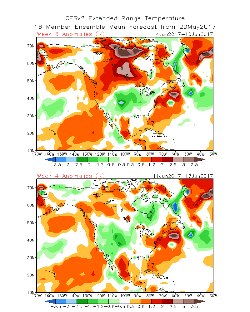
In the end, confidence is growing for more yin yang in the temperatures over North America into the first week of June. While predictability remains high, it’s still not clear whether searing, record-breaking heat will even present itself at all in the first month of summer. No signals have pointed in the direction of long-term warmth or consistent heat in the Lower 48. That said, havens of above normal temperatures still exist in the higher latitudes of Alaska, Northwest Territories, and Alberta as the pattern remains somewhat stable in those areas.